Recreation in National Parks with Jolene Nelson

Transcript from the podcast “Speak Out Loud: Stories of Strength from the Southern Downs”

SEASON 2: EPISODE 7

GUEST: Jolene Nelson, Acting Senior Ranger – Visitor Management
South West Region, Queensland Parks and Wildlife Service & Partnerships
Department of Environment and Science

PUBLISHED: 14th March 2022

Jolene Nelson Girraween National park

[00:00:00] Jolene: I guess what any National Park, or any protected area brings to people is that chance to reboot and reset and disconnect from everything, you know, the busy life that you might have come from. You’ve just got the sights and sounds of nature to enjoy. And it’s just a very simple and nice, easy way to just connect with yourself as well as with nature.

[00:00:34] Kathryn: Today’s episode is with Jolene Nelson, who is the Visitor Management Ranger for the South West Region. Jo chats with me about the National Parks in the region, the activities that are on offer, and she shares with us the recovery journey that she’s seen following the bush fires, particularly at Girraween National Park where she’s worked for over 20 years. The region has some incredible green spaces. And I really hope that this episode inspires you to get out there, to get active and to connect with nature.

Welcome to the podcast Jo. Can you tell us what’s your connection with the Southern Downs Region?

[00:01:13] Jolene: Well, I have pretty much been connected with this region for half of my life. I moved here when I was 28. I’ve worked out at the National Park at Girraween for the last 25 years. So yeah, I’ve kind of grown up here. I’ve had a family here. I love this community. I certainly found my niche. There’s so many different flavours in the region, as far as the environment and the culture and arts and food and wine and so on. I really do love this area. It’s something that I don’t hold back sharing with people.

[00:01:46] Kathryn: So you mentioned Girraween, can you tell us a little bit about the National Parks that are in the Southern Downs Region?

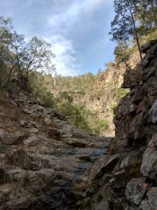
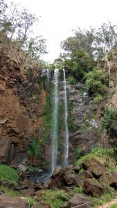
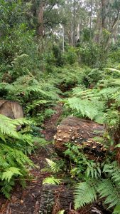
[00:01:52] Jolene: Yeah. So I probably talk about Girraween a lot because it’s kind of my favourite. But we are very lucky in this region. We do have a few different National Parks. We’ve got Girraween and Sundown National Parks on the Queensland side of the border. And then just a little bit across the border out of our region, of course is, Bald Rock and Boonoo Boonoo National Parks. But then we also have state forests as well. So where I live, I actually back onto Broadwater State Forest. And then just a bit further north is Passchendaele State Forest. So lots of protected areas, lots of places to play, lots of recreational opportunities, camping, walking, hiking overnight, mountain biking, a lot of bird watching, nature, just places to reset and enjoy and experience nature and in beautiful environments. And our climate is perfect, all year round, really, you can go walking, it’s not too hot. But there’s lots of places to swim if you do. So. So yeah, that’s what we’ve got around our region. We’re very lucky.

[00:02:48] Kathryn: In 2019 and 2020, there were some bush fires that came through the region. And that happened after several years of drought. And more recently, the region has had some flooding and we’ve seen lots of regrowth since then, but in general, how have all these different weather and climatic events impacted the National Parks in the region?

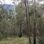
[00:03:13] Jolene: Yeah, look, I guess it’s the nature of our business. We do work in a natural environment and it’s shaped by, you know, what’s going on in the big picture. So the weather will definitely shape what’s going on down on the ground. In my time, like I’ve been there for many wildfires. We had a big one back in 2002, another one in 2005, another one in 2015, but the 2019 one was certainly odd being February. It’s not generally when we have our wildfires and it was kind of cold, like we were actually rugged up on the fire line. But that unfortunately was because we just had so much fuel because of the drought that, you know, leading up to that wildfire. And then Broadwater State Forest, was the big fire that impacted on Stanthorpe more so. That was also pretty crazy. Unfortunately it was, it occurred or started on an extreme fire danger day. Actually it was catastrophic, I should say. Yeah, it was, it was just horrible when it happened and, we knew that at some stage there would be a fire in Broadwater, but we just didn’t know to that extreme and threatening town like it did. But as far as these environments, yes, we do have these extremities. We’ve got the fires and I’ve also experienced a few floods in the region, 2011 and then again, last year, and even this year we’ve had the little sort of flash floods. And then drought. To experience the two year, 2018 to 20 drought, you know, that was the biggest for our region. Like they’re hard, you know, you fall in love with these environments and then I guess it’s like seeing a friend stressed and, and not at their best, you kind of, um, it touches your heart. You know, I would go out to Girraween to work and I would see ridges of trees dying. And yeah, it was, it was heartbreaking. And then I’d come home and I’d see my own backyard, you know, stressed. You would see populations reducing. It was really hard times, but I guess the recovery of these things is amazing, you know, and that’s nature is that you hope in the long run, yes at the time things might look terrible, but in the long run, you hope that they’re going to recover to some state where, you know, you can still go out and not see the ridges of trees dying and so on.

[00:05:29] Kathryn: You mentioned those fires that you’ve witnessed or, you know, are aware of in the last 10, 15, 20 years as well. So I’m imagining that you’ve seen recovery taking place from each of those over the longer term?

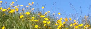
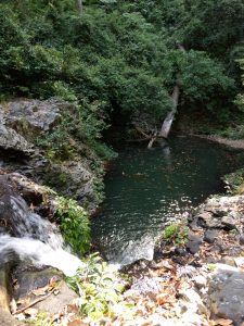
[00:05:46] Jolene: Yes, definitely. I mean, I guess after a fire, you do start to see the epicormic shoots and the regrowth starting to happen. It was a bit of a slower recovery process because of the drought. We didn’t have the follow-up rain that would generally help recover the bush. But eventually it has got there. I’ve had a few days where, I’ve kind of had a little cry, but of joy. And one of those was actually, it was exactly this time two years ago. I was at, down The Junction and finally seeing the creeks flowing. And it was like, this rain is pumping life into Girraween again. So, you feel really warm and fuzzy and hopeful that things are going to come back. And I can tell you that two years later, the bush is looking definitely healthier. We’re seeing species recover. I think we just had one of our best wildflower seasons. We’re seeing orchids that we hadn’t seen for a couple of years you know, come back out. We’ve got naturalists doing field studies, finding quolls. We’ve seen wombats on cameras. The bird life, the reptiles, everything seems to be coming back. So that’s, yeah, a really good sign of, um, better times ahead. Hopefully.

[00:06:54] Kathryn: That must be really exciting to see those changes.

[00:06:57] Jolene: Oh it is for me personally, um, yeah, beautiful. Like I go for a walk in the bush now and I’m not so kind of worried and stressed out. I just am now just back to enjoying it and getting back to discovering things about why I love being out where I am.

[00:07:12] Kathryn: Preparation for natural disasters like fires and, and drought and the floods as well can be really valuable, not just for survival, you know, surviving that particular disaster, but also for the longer term recovery for the land and the people. How do you prepare and plan for bush fires in a landscape such as Girraween?

[00:07:37] Jolene: Yeah, look a huge component of our jobs as Rangers is we’re fire managers. So it’s not just about being there as a firefighter. It’s about the years and months ahead, where you’re actually putting your thoughts and your learnings and your training into coming up with fire strategies. Now we develop fire strategies for our National Parks up to 10 years. Um, and then we’ll you know, narrow that down. It might be a year burn plan that you will come up with about where the best places need to be looked at at that time. We work with other agencies as well, so that we can at a larger level, look at our landscape and see what we need to do, to protect our communities as well as our environment. Through the year, like winter there’s a lot of work that goes into the preparation for the coming fire season. So that’s anything from slashing your fire trails to making sure your neighbours’ contacts are up to date. Your roads are maintained, so they’re ready and doing those prescribed burns, working with our First Nations People. Cultural burning and prescribed burning can be a little bit different. So combining the two definitely is more productive, uh, more effective we’ve found. And then I guess you go into the warmer seasons and it’s about being prepared and ready and trained and having resources and just waiting for those horrible extreme fire danger days and making sure your work plan is revolving around what’s going on out in the environment and you’re ready. And yeah just once you get those calls, just getting onto fires wildfires as soon as we can. So yeah, there’s, there’s a lot that we can do and that we do do, but there’s also, you know, nature that sort of will take its toll and determine how our days turn out.

[00:09:22] Kathryn: Natural environments like our National Parks are really valuable spaces for lots of different reasons. And from a mental health perspective, they give us the space to get active and have social gatherings and get connected with the natural world. What are some of the activities that people can do when they visit the National Parks such as Girraween and Sundown?

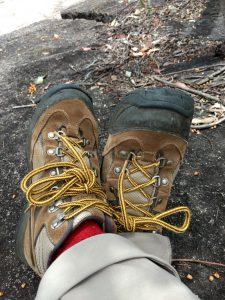
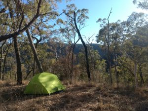
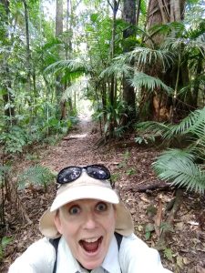
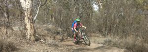
[00:09:46] Jolene: We’ve got many different types of recreational opportunities available in the different areas. So Girraween, it’s obviously very busy. But that’s because we’ve got the walking tracks that will cater for those numbers. We’ve got the small half-hour walks through to, you know, six hour walks if you’re prepared and want to, um, there’s the overnight hikes. We’ve got remote camp sites and we’ve got our camping areas as well. So, they’re kind of the main things that goes on. Lots of walking and camping. But then you’ve got rock climbing, you’ve got mountain biking, there’s orienteering. There’s a lot of birdwatching people. Naturalists love Girraween because it’s kinda like a little biological island. We’ve got a lot of species that you won’t find further north, south, east, and west. So it’ll bring a lot of your bird watchers, people that love reptiles, spotlighting at night for possums and gliders. You know, many go looking for wombats, but you gotta be lucky to spot one of those. But then you have Sundown, which is only an hour or so away from Girraween and it’s way more remote. So you’ve gotta be really prepared there. You can do remote walks and hikes. There is the Severn River, so you can go paddling, have a swim, you can even fish. And four wheel driving of course, because of its remoteness and ruggedness. So yeah, different opportunities, but I guess what any National Park, or any protected area brings to people is that chance to reboot and reset and disconnect from everything, you know, the busy life that you might have come from. You’ve just got the sights and sounds of nature to enjoy. And it’s just a very simple and nice, easy way to just connect with yourself as well as with nature. And yeah, I, I personally get a lot of calmness out of being in the bush, whether it is a ride or a walk or a climb or a swim, just to focus on yourself and just what’s important in life, I guess, you know, about looking after yourself.

[00:11:43] Kathryn: If anyone’s listening is interested in coming along to one of the National Parks and doing any of those activities, camping, for example, or bushwalking, where can they go for more information or to make a booking?

[00:11:57] Jolene: You can either just Google Girraween, and it’ll come up as the number one website, but for any of our National Parks, if you just go to the Department of Environment and Science and look for camping or booking online, you’ll just follow the links and you’ll find it.

[00:12:10] Kathryn: Jo, is there anything else that you’d like to share about the National Parks?

[00:12:15] Jolene: Girraween in particular again, the jewel of the crown, for me, it’s one of our iconic parks in Queensland. It’s actually going through a facelift at the moment. So yes. Had some hard days, but it’s having some funds injected into it to up grade our camping areas. So we’re closing Castle Rock, and that’ll be the first one to receive the facelift. And by the end of June, we hope to have three camping areas in Girraween that will cater better for the groups that we have coming. Big things happening for us, and I guess, with COVID we’ve seen that a lot of people have the need to go to these beautiful open places and be with nature. And, so I’m hoping that this is going to be a lovely way that we can get past this pandemic.

[00:13:01] Kathryn: Lots of opportunities for people to get out there and get active and nurture themselves.

[00:13:06] Jolene: Exactly, exactly. And yeah. Leave those gadgets at home. Bring some marshmallows, sit around the campfire with the kids and then just enjoy nature.

[00:13:16] Kathryn: That sounds beautiful. Thank you, Jo.

Thanks for listening to the Speak Out Loud Stories of Strength podcast with me, Kathryn Walton. I hope this episode inspires you to get involved and to get connected with your community. You can find the transcript and any links mentioned in this episode, in the show notes and please share the podcast with your friends. We acknowledge and pay respect to the past, present and future Traditional Custodians and Elders of this nation and the continuation of cultural, spiritual, and educational practices of Aboriginal and Torres Strait Islander peoples. Series Two of this podcast has been jointly funded under the Commonwealth and State Disaster Recovery Funding Arrangements 2018.

How to find parks where I live

how to find parksAt the time of writing this post, it’s late May 2020 and Australia is going through a staged process of coming out of isolation. The world is striving to manage human health needs during the COVID-19 pandemic. I’m seeing and hearing a lot of enthusiasm from people to get out and socialise more, but also to reconnect with outdoor spaces and places. That includes people who haven’t been especially interested in the outdoors before. I think people have become more aware of the role that getting out and about and connecting with the outdoors has on mental health and well-being.

Lots of people have been asking questions about how to find parks where they live, where they can go, what walks are around, how to get to places, what facilities are available in different locations, whether particular trails are suitable for young families or people with mobility issues, how to get started bush walking and so on.

In this article I’m going to begin answering some of those questions. I’ll give you a run down on what types of parks we have in Australia that you can access for outings, picnics, walks, bush walks and other activities. We’ll look at what the differences are between National Parks, State Forests, Regional Parks and privately managed parklands and what sorts of activities can you do there.

I wrote last year about the Goomburra Section of Main Range and in future posts I’ll share information about some of my other favourite parks as well.

What are National Parks?

National Parks and reserves are publicly owned landholdings that are protected and managed by Federal or State authorities. Many National Parks are open for public recreation activities and have infrastructure such as toilets, picnic shelters, campgrounds and marked walking trails. Some National Parks have designated mountain bike (MTB) trails and locations for abseiling, rock climbing, bouldering, and other adventurous activities. There are some National Parks with no facilities and some that are not open to the public.

If you want to know what National Parks are in your area, what facilities are there, what activities you’re permitted to do and so on, you can start by looking up the National Parks website in your state and check the Parks Australia website for information about the National Parks that are managed at the federal level. Here are some clickable links to help you find a National Park:

Queensland
New South Wales
Victoria
Tasmania
South Australia
Western Australia
Northern Territory
Australian Capital Territory
Parks Australia

Visitor Information Centres are dotted around the nation and are a great source of information about the National Parks in their areas.

Regional tourist associations will also have information including accommodation and hospitality options nearby.

Social media groups is another way to find out more about National Parks and other parks as well. Many people love to share their knowledge of different parks so this can be a fantastic way to get first hand information about people’s experiences and to ask questions that you might have. But don’t forget to check with National Parks for up-to-date information as well, especially about current closures. National Parks can be closed for maintenance, bushfires, extreme weather and other reasons so I recommend checking every time before you set out for a visit.

There are entry fees for visiting some National Parks and for camping which you may need to book ahead. Some National Parks have an online booking system for camping, and others are first-in-first-served. In certain circumstances you may need to apply for a special permit well ahead of time if you want to undertake activities such as running organised events or commercial tours.

What are State Forests?

State Forests are publicly owned lands that are designated for multiple uses and which may be managed by your state National Parks, plantation companies or other enterprises. There is a lot of variation in what activities are permitted in each state forest. Mountain biking is popular in some State Forests, as well as walking, bouldering, and 4WDing.

State Forests are also subject to closure for harvesting timber and other reasons, so once again it’s best to check what’s on offer before heading out. My suggestion is to get on the Internet and search for State Forests in your area to find out more. Very generally there are fewer facilities and less infrastructure provided at State Forests than in National Parks so you need to be prepared to be self-sufficient.

What are Regional Parks?

There are lots of other public parks and reserves that are not National Parks or State Forests. Many of these are managed by regional councils or other local authorities so we’ll refer to them here as Regional Parks. They could also be managed through partnerships between different authorities and even with the private sector. Because the management can vary from place to place, you’ll need to look up your local council government website, or contact your Visitor Information Centre or your regional tourist association for more information about what’s around and what you can do there.

I want to give another plug for Visitor Information Centres. They can be a wealth of information about all sorts of local attractions, not just parks. And they should be able to tell you or give you brochures about local marked or signed walks, places where you’re allowed to take your dog, and parks where there are public toilets. Information Centres are often staffed by volunteers who are enthusiastic about sharing their knowledge of their area.

How do I find out about privately owned places that I can visit?

There are some privately owned or managed properties that the public can access for recreation, often for a fee. I’m thinking here about campgrounds, bush retreats and farm properties which allow you to camp and/or use the property for bushwalking, bike riding, climbing, bird watching, photography, picnics and so on. These properties are usually required to comply with certain regulations or have a licence and insurance to allow visitors. Once again you can find out about them through Internet searches; social media groups; Visitor Information Centres; and travel, tourism and accommodation platforms.

Your mental health will thank you for it!

I hope this article has given you some helpful information about how to find parks in your region and what the differences are between National Parks, State Forests, Regional Parks and privately managed park lands. All of these parks offer a different range of outdoor experiences and activities. It’s absolutely vital for your mental health and overall well-being to get out, to be active and to connect with nature. And my aim is to help you to do that in ways that are safe and health-giving as well as good for the environment.

Listen to the audio version of this blog on the podcast!

You can listen here to the audio version of this article on the Outdoors is my Therapy podcast, or find it on your favourite podcast player and remember to subscribe so you won’t miss future episodes about places you can go to get your outdoor therapy!

Daisy Spoke

Discovering mountain biking as life’s ultimate parallel universe in her middle age, Kathryn Walton shares information and reflections in ‘Daisy Spoke’ that inform, inspire and empower women to a healthy and active lifestyle.

Where to go walking in the Southern Downs

Whether you’re a visitor or a local, there are plenty of choices when it comes to walking in the Southern Downs. The region is about 1 ½ to 2 hours south west of Brisbane in Queensland. The two main urban centres are Warwick and Stanthorpe, with dozens of smaller rural towns and villages across the region.

This post is an overview of just some of the many walks you can choose from. Keep an eye out for future posts that will give you heaps more detail on a selection of the bushwalks and mountain bike trails in the region like the one I wrote last year on Bushwalking in Goomburra, Main Range National Park.

Thinking about taking up hiking? My blog post How To Get Started Bushwalking will get you going!

Walks in and around Warwick

Queen’s Park River Walk

Condamine River winds through parkland
Walking in the Southern Downs – the beautiful River Walk in Warwick

The Southern Downs region promotes 5 different urban walks close to the Warwick CBD which you can follow along on this map. The popular River Walk at Queen’s Park has recently been extended past Hamilton Oval in the direction of Gillam Park. The River Walk is also suitable for bicycles, scooters, prams and wheelchairs with easy access to toilet facilities and picnic tables. There’s plenty of shade and a fenced off-leash area for dogs.

Walks in and around Stanthorpe

Quart Pot Creek

Quart Pot Creek is an absolute gem in the centre of Stanthorpe flanked by parklands on both banks with extensive walking and cycling paths, gardens, picnic tables, toilets and play equipment. You can access this beautiful green belt from many points along its length including Apex Park, Lions Park, Heritage Park and from the Stanthorpe Visitor Information Centre.

Mt Marlay

Mt Marlay is a small bushland reserve in the middle of Stanthorpe, popular for many years with locals on their regular walking routes. There are a couple of short, marked walking tracks on Mt Marlay which you can see on the map below. The regional council and the Southern Downs Mountain Bike Club have recently begun developing a small network of mountain bike trails here which are clearly marked so that you don’t accidentally wander off the dedicated walking tracks onto the mountain bike tracks.

walking in the southern downs - Mt Marlay map
Walking and MTB trails at Mt Marlay, Stanthorpe

Donnelly’s Castle

Donnelly’s Castle  is about a 20km drive to the north west of Stanthorpe. Access is from Castle Lane which comes off Donnelly’s Castle Road at Pozieres. Donnelly’s Castle is a natural formation of the locally occurring granite rocks and boulders which apparently served as a fabulous hideout for the bushranger known as Thunderbolt. You can really imagine the truth of this legend when you scramble up, around and through the rocks and peer into the distance from the lookout at the top. Kids and adults alike are bound to have a heap of fun here exploring the ‘castle’. I’d recommend close supervision of young children and keeping a keen eye out for snakes. Toilet facilities and picnic tables are available.

Girraween National Park

Rocky expanse of Girraween National Park
Walking in the Southern Downs is stunning at Girraween National Park

Girraween is about a half hour drive south of Stanthorpe. This unique national park is a landscape of stark contrasts. Girraween is famous for its abundant wildflowers and its rugged granite outcrops. The national park is also home to an extensive variety of birds, kangaroos, frogs, reptiles and other wildlife and is a popular place for day visitors and campers. As I write this article in January 2020, the camp grounds have been closed for some time due to ongoing drought, and the area has suffered from recent bushfires. As with all natural environments, Girraween changes with the seasons and I’ve loved watching the cycles of regeneration here over many years. There are signed bushwalks at Girraween ranging from 280metres to 11kms. Or simply explore the granite rock pools near the day use area. Toilet facilities, picnic tables and BBQs available.

You can read more about Girraween in my Great Backpacking Adventures series.

Sundown National Park

Sundown National Park rocky gorge
A rocky gorge at Sundown National Park

Sundown National Park can be accessed by most conventional vehicles from the south near Glenlyon Dam, or from the north off Texas Road and onto Nundubbermere Road. A third access point is along Sundown Road via Ballandean however once at the National Park the tracks become rough and steep so a 4WD is recommended along here. Sundown has several walks of varying lengths and difficulty as well as some camping areas. Look at the Sundown National Park website to plan your trip before heading out there as it is more remote than other regional parks with fewer facilities.

Walks in and around Allora and Goomburra

Dalrymple Creek Park

Dalrymple Creek Park is a shady park along the banks of Dalrymple Creek in Allora. The walking trail leads you along the banks of the creek with toilet facilities, picnic tables, BBQs, and play equipment along the way.

Goomburra Section, Main Range National Park

Waterhole in Goomburra National park
The Cascades walk in Goomburra National Park

The Goomburra section of Main Range National Park is about 40kms east of Allora. Sections of the road into the National Park are unpaved and at times can be difficult for low clearance vehicles to navigate. After rain there can be several water crossings into the entrance of the park. A day use area and camping sites are available within the National Park as well as toilets and a variety of walking tracks that begin at the camping and day use areas, as well as other walking tracks that can be accessed from Lookout Road. Goomburra walks range from less than a kilometre to 12 kilometres long. All the walks are on unpaved surfaces and can include steep sections, natural obstacles (eg tree roots) and creek crossings. Spectacular views of the surrounding valleys and ranges can be seen from the high points of some of the walks.

Walks in and around Killarney

Queen Mary Falls, Main Range National Park

Queen Mary Falls
Queen Mary Falls in Main Range National Park

Queen Mary Falls is about 45kms east of Warwick. It offers a beautiful day use area with car parking, picnic tables, toilets, water and BBQs as well as a small kiosk across the road.  The walk to The Falls is a 2 km circuit through the forest to the bottom of the Falls and back up again. The walk is steep in places, has stairs and is not suitable for prams or wheelchairs. The causeway at the bottom can be slippery.

If you’re looking for a shorter walk that’s suitable for prams, wander along to the two lookouts on either side of the Falls just a couple of hundred metres from the car park.

Browns Falls

Browns Falls is accessed from Spring Creek Road as you travel from Killarney towards Queen Mary Falls. Park your vehicle at Brown Falls Park where there is play equipment, picnic tables, BBQs and toilet facilities. Follow the track under the road and along the watercourse in an easterly direction for about 600 metres. The track is not well defined in places and you will need to scramble or rock hop along the watercourse. Take care as it can be very slippery when wet. The falls plunge into a beautiful waterhole surrounded by rock.

Walks near Maryvale

Cunningham’s Gap Section, Main Range National Park

Cunningham’s Gap is at the top of the Range on the Cunningham Highway about 90 minutes south west of Brisbane or 45 minutes east of Warwick. The closest town in the region is Maryvale only 15 minutes on the western side of the range.

There are two main access point to the walks in this section of the National park. At the top of the range known as “The Gap” there is a small car park and toilet facilities on the northern side of the highway with additional limited parking along the southern side of the highway. If you are crossing the highway to access the facilities or the walks on the other side, take great care and follow any signage that has been placed there for your safety as this is a very busy highway. Most of the walks are accessed from the northern side of the highway.

Kathryn looks amazed and wide-eyed at the rainforest in Main Range National Park
The rainforest in the Cunningham’s Gap section of Main Range National Park is stunning!

The alternative place to access The Gap walking tracks (and my personal favourite because it’s off the highway!) is via the West Gap Creek picnic area on the western side of The Gap. From Warwick, West Gap Creek picnic area is on your left just past “Stacey’s at the Gap” a couple of kilometres before you reach the The Gap. There are two small car parking areas, an extensive grassy picnic area, toilets, water, picnic tables and access to the Box Forest Walking Track which takes you about 2.5 kilometres through rainforest uphill to The Gap and the other walks. Walks here range from 1.6 kms to 12 kms long with varying levels of difficulty. Once again, check the National Parks site if you intend visiting as there were extensive bushfires through the Park in late 2019 resulting in closures of most walks throughout Main Range.

Some things to remember when walking in the Southern Downs!

There are simply SO MANY wonderful choices when it comes to walking in the Southern Downs. With so much natural beauty surrounded by a rural landscape, it’s the perfect place to relax and unwind. But safety always comes first! Here are a few reminders to help you have a truly fabulous time whilst minimising risks:

  • Always prepare by doing your research before leaving home
  • Check the National Parks ALERTS web page for closures and other advice, or contact the Rangers at the Park you plan to visit
  • Take plenty of drinking water and food for everyone in your walking group as drinking water may not be available
  • Wear comfortable closed shoes suitable for the terrain
  • Protect yourself from the sun
  • Follow signage and advice from authorities such as staying on track and taking all your rubbish with you
  • Be First Aid aware and be well prepared including knowing how to manage snake risk and other injuries
  • Mobile service may not be reliable in all areas
  • Let someone know where you are going and what time you expect to be back
  • Make sure you have plenty of fuel in your vehicle – some parks like Sundown National Park are a long way from fuel stations

For more information about walking in the Southern Downs

For more information about the parklands across the Southern Downs region, go to the Southern Downs Regional Council website or check with the Visitor Information Centres or the many tourism operators.

Let me know your favourite places and spaces for walking in the Southern Downs and further afield! And join us over on our community Facebook Group Outdoors is my Therapy where you can share ideas and inspiration no matter where you live or how you love to spend your time outside!

Daisy Spoke

Discovering mountain biking as life’s ultimate parallel universe in her middle age, Kathryn Walton shares information and reflections in ‘Daisy Spoke’ that inform, inspire and empower women to a healthy and active lifestyle.

How to keep exercising outdoors in the drought

“How CAN you keep exercising outdoors in the drought????”

I’m writing this blog post because over the past year lots of people have said they just don’t know how I can keep exercising outdoors in the drought. We typically think of nature as nurturing and health-giving, a place of solace and retreat. Being confronted by a shockingly dry environment with frequent bushfires, brown landscapes that used to be green, National Park closures, and dry waterways, it’s clear that nature has a shadow side as well.

flowers before the drought

“It’s REALLY tough!”

To be completely open, I’ve also questioned how I can keep exercising outdoors in the drought. The whole climatic situation has been tough. Really tough! The ripple effect of the drought has swept up farmers, wildlife, local businesses, ‘town’ people, and those in the cities. We’re all affected in various ways either directly or indirectly. There’s a pervasive and damaging sense of hopelessness, and like any emotion, it’s contagious. Yet a sense of hope is exactly what we need to survive difficult or traumatic situations. Where there’s hope, there’s life. Without it, we spiral into a self-fulfilling doom and gloom mentality.

Exercising outdoors has been very confronting. I can’t walk on my home trails without seeing or smelling death. The brown dust colours my view as if I’m looking through a sepia filter. Ticks are in plague proportions. Swarms of good ole slow country flies are driving me nuts. The heat is unbearable. And there’s not enough water for washing your hair after a workout.

My stress tank is overflowing! How about you?

My connection with nature runs very deep, as does my yearning to be active. But in this tough time, I also came down with shingles. My stress tank began to overflow. I had to do something differently. Bushwalking and bike riding whilst constantly thinking about the drought and feeling unwell was contributing to the stress.

So what CAN you do when being in nature is SO stressful?

You have to put your creative thinking hat on to find a solution when things get tough. What worked before is no longer effective. The questions people keep asking me (and that I wanted solutions for too) are:

  • How can I reconnect with the side of nature that heals and nurtures and teaches?
  • How can I enjoy my time outdoors without feeling overwhelmed?
  • What mindset shift do I need?
  • What actions do I need to take?
  • How can I keep exercising everyday?
exercising in the drought
Exercising in the drought has it’s challenges

So I set you to explore this new territory and experiment with the possibilities!

Here are 6 solutions that I’ve discovered. I hope they work for you too!

1. Podcasts

If you haven’t got on the bandwagon yet, then you really need to! Podcasts are audio shows, a bit like a radio show, that you can either stream from the Internet or download onto a device to listen to later. I download episodes from my favourite shows onto my phone, plug my ear phones in, and listen to inspiring, energising interviews while I walk. Instead of focusing my attention on my surroundings, I lose myself in the show and arrive back home with excitement for life and new ideas to put into action. Watch out for a future blog post about my favourite podcasts suitable for Android or Apple.

2. Set an Intention

Before heading out on a walk or ride, I often choose an intention – something I want to focus on or get out of my experience. This is a personal choice, so it can be anything at all. Some of the intentions I’ve set for myself go like this:
“Today I will notice new growth”
“Today I will focus on the sensations in my legs”
“Today I will find fun”
“Today I will discover colour”
“Today I will notice sounds”

3. Mindful Walking

With mindful walks I like to focus on one sense at a time and when I notice my mind has wandered away from my body, I gently bring it back to rest on my senses. I’ve especially enjoyed focusing on my sense of hearing – noticing the many different bird calls, the sounds of the breeze in the trees, my footsteps on the ground, insects buzzing around, wallabies bounding along. I usually focus on one sense for a few minutes, then move onto another one. With my sense of touch, I focus on how it feels to have clothes on my skin, feet in my shoes as I take a step, muscle movement, sunscreen on my face, leaves brushing my skin. When I focus on my sense of sight, I challenge myself to find colours and light and patterns that I don’t normally notice. You can also use a meditation app with a guided practice for mindfulness of walking.

4. Photography

I’ve discovered that taking photos along the way really helps me to bring my attention to the beautiful things. Sometimes I combine photography with an intention or a mindful walk so that I can collect images that bring me joy, and at the same time it helps my brain to collect evidence that there is hope.

5. Make it Social

Walking or riding with other people can be really helpful because the focus is on that invisible connection between myself and someone else. Give me a deep and meaningful conversation with a friend any day, plenty of laughs, a chance to debrief the stuff of life that drives me crazy, and to celebrate the rest. Sometimes, too, there’s a sneaky competitive edge that sees me running or riding faster when I’m with others. Inevitably that ends up in a heap of laughs too, gasping for air, heart pounding out of my chest, and the satisfaction that I’ve done my weekly interval training.

6. Mix it up

I’ve always said “I’m not a gym person”. I’ve built a business and identity around my outdoor adventures. BUT, being unwell and being in the drought has helped me re-set my rigid thinking about exercise. Instead of going outdoors everyday, I went to an aqua class with a friend, did loops of the river walk in town where it’s a bit greener, and took up an irresistible offer to join a gym. I’ve extended the variety of exercise I get which is a fantastic thing! It will help me enjoy and have greater success with my outdoor adventuring which I’m still doing at least a couple of times a week. Going to the gym also gets me focusing on my sadly neglected strength training (one of those things I really ‘should’ be doing at my age!), all whilst staying out of the flies and heat. I get to make new friends and pace myself sensibly (sort of) as I recuperate. At home I’ve also begun a more regular yoga practice – something I’ve been wanting to do but it’s been a lower priority until now.

To Sum Up: Choose Your Focus!

It’s really all about CHOOSING WHAT YOU FOCUS ON. When we feel like we have What's my plan of action to deal with this issue?no control or influence over a situation (like the drought), it’s important to push the pause button, think about it creatively, and choose your focus. Like many people, I’ve struggled with exercising outdoors in the drought. The ideas I’ve shared in this article have made a huge difference to me, my mental state and my physical health. My hope is that they help you too.

Let me know what works for you! Have you got some other ideas to share with our readers?

Daisy Spoke

Discovering mountain biking as life’s ultimate parallel universe in her middle age, Kathryn Walton shares information and reflections in ‘Daisy Spoke’ that inform, inspire and empower women to a healthy and active lifestyle.

Bushwalking in Goomburra, Main Range National Park

Regardless of your level of fitness there are plenty of options for bushwalking in the Goomburra section of Main Range National Park on the Southern Downs. As with many National Parks, it is a privilege to be able to share in the natural wonders and history of the area. There are varying stories about the meaning of the word “Goomburra” taken from the local Aboriginal language. The European history of the Darling Downs area relates to transport routes between the east and west, the logging industry, and frequently violent conflict with the Traditional Custodians of the land.

About Main Range National Park

Main Range National Park covers over 30 000 hectares in the Gondwana Rainforests of Australia World Heritage Area in south east Queensland. With an amazing diversity of plants and animals and unique terrain, Main Range is a popular place for people to picnic, bushwalk, camp and venture into the more remote areas of the Park.

Main Range National Park is divided into 3 sections including Queens Mary Falls, Cunningham’s Gap, and Goomburra. Let’s take a closer look at the Goomburra section. 

Are you new to bushwalking? Read some tips and hints on how to get started bushwalking.

Goomburra Section

bushwalking Goomburra 3
Explore the wide variety of habitats when you go bushwalking in Goomburra

The Goomburra section of Main Range National Park is about 170kms south west of Brisbane by road or about 55kms north east of Warwick. The Park offers spectacular scenery with rugged mountains, scenic lookouts, open dry forest, and rainforest. The Park habitats provide shelter to a variety of Australian flora and fauna including some endangered species.

Accommodation

Camp sites with composting toilets are provided in this section of the Park, and other private camp grounds and accommodation options are located nearby.

Access

Hidden away from the highway, access to the Goomburra section of the Park is along Inverramsay Road. Travelling along here reminds you of where your food comes from. The road meanders along the beautiful Goomburra Valley, home to grazing, dairying, vegetable and crop farms, as well as recreational enterprises such as 4WD parks and private campgrounds – very popular destinations for long weekends and school holidays.

The final approach to the Park is unfenced and unpaved so be aware of cattle wandering across the road. At times you may need a high clearance vehicle to navigate the unpaved sections. After rain there can be several water crossings as you enter the Park.

Kurrajong Picnic Area is on your left near the intersection with Lookout Road and a nearby information sign. Driving straight ahead you’ll discover two campgrounds with toilets and access to some of the walks from the car park where the road terminates.

Driving along Lookout Road you’ll wind your way up a narrow unpaved road which gives access to more walking tracks.

Bushwalking Tracks

There is a variety of walking tracks in the Park ranging from short and easy walks to steeper and more

bushwalking in Goomburra 1
Rock pool on The Cascades track

challenging half-day walks.

Dalrymple Circuit (1.2kms return) is a Class 3 walk with interpretative signs which winds through the forest and creeks. This walk is suitable for families or anyone looking for a short walk that gives you a taste of what Goomburra has to offer.

Cascades Circuit (6.5kms return) is a Class 4 track that’s a bit longer and more challenging. Wind your way up through the rainforest crossing the creek numerous times to sit by the rocky pools at the upper reaches.

The Ridge Track (5kms return) is a Class 4 track that takes you through quite steep terrain with dry forest and rainforest. Take care on the steep fire road and walking tracks as the gravel can be quite slippery whichever direction you go.

North Branch Track (7kms return) is a Class 4 track that begins off Lookout Drive near the Kurrajong

bushwalking Goomburra 2
Lush ferns growing on the Ridge Walk track

picnic area. From the picnic area, walk to the other side of Lookout Drive and cross the creek. On your left you’ll see the start of the North Branch Track which takes you through mostly dry open forest until it reaches the edge of the rainforest which is a perfect spot to rest and have a snack before returning the same way you came.

Araucaria Falls (3.6kms return) is a Class 4 track that takes you through rainforest to the base of the falls. Access to this walk is along Lookout Road.

Sylvesters Lookout (940m return) is a short and beautiful Class 3 track that can be accessed from Lookout Road. The walk takes you to a spectacular lookout.

Mount Castle Lookout (960m return) is another short, beautiful Class 3 track that can be accessed from Lookout Road. Walk through rainforest and be rewarded with amazing views below.

Winder Track (12 kms return) is a Class 4 track that goes out-and-back from the end of Lookout Road. This track is vehicle-width leading you through the forest to ‘the winder’ which was used in the bygone days of logging and timber cutting in the area. Although listed as a Class 4 track, the walk undulates fairly gently and does not generally have much in the way of obstacles. At the start of the walk keep an eye open on your right for views across the valley.

The art of not-bushwalking

If you’re not feeling up to the challenge of bushwalking in Goomburra, or maybe you have young children to care for, simply have a wander or a quiet sit-down in the campgrounds or picnic area. There’s always so much to see right on the edge of the forest, with birds flitting in and out, echidnas, wallabies and kangaroos, reptiles, and frogs and other water-based creatures along the creek. Take a book or some binoculars or a pack of cards and enjoy the peaceful surrounds as you reconnect with the natural world around you.

Things to watch out for

There are the usual things to watch out for whilst bushwalking in Goomburra including snakes, ticks, leeches, flies and mosquitoes. You may also see some stinging trees depending where you walk, so be careful not to touch these. Check the parks site for ‘alerts’ of bushfires and park closures. As always the recommendation is to be prepared with first aid knowledge, a snake bandage, sun and insect protection, wear long sleeves and trousers, slip on a hat, and take plenty of water with you as it can be quite hot and humid on the walks. Let someone else know where you are planning to go and let them know when you’ve returned so they don’t unnecessarily send out a search party. Mobile service is very poor throughout the area.     

It’s time to stop dreaming and start bushwalking in Goomburra!

bushwalkingSo….. enough reading and dreaming about it! It’s time to get organised and get out there for real!

WHICH TRACK WILL YOU BE BUSHWALKING IN GOOMBURRA?

Walking Track Classifications

This article refers to the Australian Standard for classifying the level of difficulty of walking tracks. The Goomburra Section of Main Range National Park has Class 3 and 4 walking tracks which are defined below:

Class 3 Walking Tracks

  • Well-defined, distinct tracks, variable in width. Muddy sections, steep grades and steps may be encountered. Some exposed roots and rocks.
  • All junctions signposted and may include interpretive signs.
  • May be partially overgrown; hazards such as fallen trees and rockfalls may be present.
  • No formed creek crossings; cliff edges and lookouts generally not fenced; appropriate caution required.
  • Reasonable level of fitness required and ankle-supporting footwear recommended.

Class 4 Walking Tracks

  • Distinct tracks, surface likely to be rough with exposed roots and rocks.
  • All junctions signposted. Markers may be used where necessary (e.g. at creek crossings).
  • Variable in width; muddy sections, steep grades and extensive steps likely to be encountered.
  • May be overgrown; hazards such as fallen trees and rockfalls likely to be present.
  • No formed creek crossings; no fences on cliff edges or lookouts; high level of caution required.
  • Moderate fitness level and ankle-supporting footwear strongly recommended.
Daisy Spoke

Discovering mountain biking as life’s ultimate parallel universe in her middle age, Kathryn Walton shares information and reflections in ‘Daisy Spoke’ that inform, inspire and empower women to a healthy and active lifestyle.

How to get started bushwalking

I meet many people who would like to take themselves or their family on outdoor adventures, but they’re not sure how to get started bushwalking. In this article, I’ll outline some simple steps you can take to get started, stay safe, and have loads of fun! Keep your eyes open for a whole series of articles on places you can bushwalk across South East Queensland and beyond.

What equipment do I need to go for a bushwalk?

The basic equipment is really quite simple:bushwalking boots
  • a comfortable and sturdy pair of covered shoes
  • a drink bottle,
  • a hat, and
  • some sun protection such as sunscreen and sun-safe clothes
  • basic first aid and medical supplies for yourself or your group such as an asthma puffer and snake bandage – I slip a snake bandage into my pocket or backpack even on short walks
If you’re bushwalking in cold or alpine areas, you’ll also need:
  • warm layers of clothing eg jacket, beanie.
And if the weather is damp, you might like to have:
  • a rain coat or poncho
What else do I need to think about for longer or more challenging walks?

As you become more experienced, you might like to go on longer or more challenging bushwalks, so it’s important to have:

  • well-fitting shoes and socks suitable for the terrain and the climate
  • a small backpack that can hold all the gear you’ll need for an awesome day out – snacks, water, extra layers of clothing, raincoat, maps, emergency devices, and a camera,
  • some people like to wear gaiters to protect against snake bites and prickly plants
What about overnight hikes and camps?

If you plan on a multi-day bushwalk you’ll also need to have:bushwalking and camping

  • a well fitting backpack large enough to hold your gear, especially if you plan to be self-sufficient,
  • a shelter such as a tent,
  • food for the duration of your expedition
  • enough water plus a bit extra to get you to your next water supply – this includes water for drinking, cooking and cleaning,
  • a water purification system if you plan to collect water from untreated water supplies,
  • a sleeping mat,
  • sleeping bag,
  • toiletry items,
  • a trowel and toilet paper,
  • extra clothes to sleep in or if you want a clean set of clothes for your second day,
  • a stove and cooking equipment,
  • maps and navigation equipment such as a compass and / GPS, and
  • emergency communication equipment such as an emergency beacon, EPIRB, or GPS communication

We’ll cover equipment for overnight hikes in more detail in a future article.

How much water will I need?

The amount of water you need to take depends on lots of things including how far and how long you’ll be bushwalking as well as the temperature and humidity, whether there is drinking water available along the way, how strenuous your walk is, and how much you as an individual need to drink. A very rough guide is usually a minimum of 2 litres per day, however I’d recommend more than that especially if the weather is hot, and just in case you stay out longer than planned. If you’re planning to cook, you’ll need extra as well.

How much food should I take on a bushwalk?

If you’re going for a short walk (less than an hour), you generally won’t need to take food. bushwalking foodHowever, I think every walk is much more fun when you stop for a little picnic along the way. Choose food that won’t easily spoil or be squashed. It also pays to think about how heavy your snacks are and take a bag or container to transport your scraps back home.

Where can I go bushwalking?

Popular public walking spaces in Australia can be found in regional or council parks, state reserves and forestry, and in national parks. There also some privately owned land holdings that are open to the public. You can search the Internet for what’s available in your local area. Regional tourist information sites and centres also provide this information. Australian walking trails are often classified according to levels of difficulty from Class 1 to Class 5. This makes it easier for you to plan the right type of walk for your group.

In future articles I’ll share some of my favourite places with you.

How much does it cost to go bushwalking?

Most walking trails in Australia are free, however there are some parklands that require you to purchase a permit for vehicle entry (such as some national parks in some states). And you need to book ahead and pay an entry fee for some multi-day walks which assists with managing and maintaining the trails and surrounding environment.

Is it safe to go bushwalking alone?

Walking solo can be a great experience if you are properly prepared. I’d recommend:

  • Tell someone where you are planning to go and when you expect to be back, and then make sure you let them know you’ve arrived home safely afterwards.
  • Be extra careful about preparing and packing for your walk because you only have yourself to bushwalking equipmentrely on.
  • Take some extra water and food, as well as first aid supplies.
  • Stick to trails that are within your level of expertise.
  • Take a phone but don’t rely on having mobile coverage everywhere. (Remember you can use your phone’s GPS to help you work out where you are even if you don’t have phone coverage. The GPS function uses a satellite system not a mobile phone system.)
  • Download navigation and emergency services apps and practise using them before you go! Some suggestions include:
    • Orux Maps
    • GPS to SMS
    • Emergency+

How can I meet other people to bushwalk with?

Here are a few ways to meet other people who like to bushwalk:

  • join a bushwalking club
  • look on Facebook and MeetUp for bushwalking groups and activities
  • find a professional guide who can lead you on an organised walk
  • ask about walking groups and organised activities at tourist information centres and national parks offices
  • say hello and strike up a conversation with other people you meet along the trails – you’ll be surprised how much information other people have!

So there you have it – a brief introduction on how to get started bushwalking. Join me for future articles where we’ll explore more details about the amazing places you can go no matter your level of fitness or experience. And send me a message if there’s a particular question or topic about bushwalking that you’d like answered.

Daisy Spoke

Discovering mountain biking as life’s ultimate parallel universe in her middle age, Kathryn Walton shares information and reflections in ‘Daisy Spoke’ that inform, inspire and empower women to a healthy and active lifestyle.

Have you failed if you don’t reach your goal?

Goals, Outcomes and Benchmarks

There is too much emphasis these days on outcomes. If you work for a government or corporate organisation, you’ll likely have KPIs (Key Performance Indicators) to aim for. Even if you work for yourself, you’ll be required at some point to reach targets related to income, funding for a project, or your client’s benchmarks. Perhaps you set specific markers for yourself in your work or personal life. Whatever label you slap on them, they’re simply ‘goals’. And success is all about reaching your goal. But have you failed if you don’t reach your goal?

The Benefits of Having a Goal

Not everyone is a fan of goal-setting. Personally and professionally I love them. However I’m very choosy about what goals I commit to, as well as the finer detail that goes with them (that is, the who, how, why, when, where, what and how of the goal). I believe that having a goal to aim for can give you purpose, focus, motivation, structure, and a feeling of success when you’ve reached it.

Failing to Reach Your Goal

I also know what it’s like to NOT reach a goal. In fact there are many goals I haven’t reached. Do I consider myself a failure because I haven’t reached those goals? Definitely not. There’s much more to a goal than the final outcome (despite what business model you might be working under!)

Goals include the nitty gritty mentioned above – the who, how, why, when, where, what and how. If you only look at the ‘what’ factor (that is, the desired outcome), then you’re selling your goal short.

Real-life Examples of Failing to Reach a Goal

Overnight Expedition Fail #1

Last year I set off on an overnight backpacking trip to reach a remote bush camp on an escarpment with a small group. We knew that others had been there before. We even had some trail maps of where they’d been although we found very little other information about the area. We began our trip on an established footpad then veered uphill very steeply off track as we navigated along a ridge line. The going was very tough. There was huffing and puffing; tears; and many self-proclaimed moments of “I can’t do this!” After hours of sweating it out we realised we were simply not going to make it. The route we’d taken was described somewhere as ‘moderate’ but it was nothing like my idea of moderate at all! My new grippy-soled Merrill’s were no match for the steepness of the terrain and I couldn’t get the image of myself sliding uncontrollably down the mountain out of my mind. As dusk arrived and we were still miles away from our destination, we chose to retrace our steps back to a small saddle and set up camp for the night.

As it turned out, camping here in the middle of nowhere was the most magical experience! Stars and night sounds accompanied our tired bodies and minds as we settled down to rest after one of the most gruelling walks I’d ever done. Disappointment called loudly, but I put it in the background, completely mesmerised by what was before me.

Did I fail? Yes, it’s true I failed to reach the destination at the time I planned, but I did not fail in every other aspect of the goal. I tried my hardest on this walk, gathered more information about the terrain, discovered that having a rope would have been handy to navigate some of the steep sections, and I accidentally uncovered the world’s most amazing remote camping spot!

Remote camping
PHOTO CREDIT: Kathryn Walton (author)

Overnight Expedition Fail #2

So gruelling was this trip that I wasn’t interested in making another attempt of this same route. However last week the opportunity arose to try a different route …. to the same destination. Hmmm ….. this could be interesting! So with backpacks on, new maps and routes, a conversation with the Park Ranger to gather more local knowledge, some added confidence, and we were off. We even organised a small water cache for ourselves about 6kms from where we left our car in case we needed it on our return trip. Lesson learned from previous trip!

This time the terrain was not steep and slippery. It was rugged in a different way. Following old logging roads through rainforest proved so slow that it was almost impossible. Our planned route was entirely overgrown with woody vines, weeds, stinging trees and thickets. Navigating using map and compass seemed impossible in the thick rainforest, and using GPS was also haphazard with the dense canopy disrupting satellite communication. Progress was terribly slow. Climbing and untangling, diverting and problem-solving, re-calibrating and double-checking. We gradually made our way through the jungle.

Once again as the sun dropped low in the western sky, we acknowledged we’d failed to reach our destination once again. We’d need at least one more full day of navigating and pushing through scrub and forest to get there at this pace.

Did I fail? Yes, it’s true I did not reach the destination in the allotted timeframe, but in every other aspect I experienced success. I’d tried something new, hadn’t given up, approached each problem that arose with calmness (well, almost!), deeply appreciated the majesty of the rainforest around me, and felt connected with all who had been here before me, and all who would come after me.

Not reaching your goal does NOT equal failure!

So in my opinion, if you set a goal and don’t achieve it in the way you planned or in the time frame you set, that does NOT mean you’ve failed. It simply means you haven’t arrived there yet. It’s an opportunity to learn, re-assess, and redesign. Sometimes it’s an opportunity to say “Actually, that goal isn’t what I want after all. I’m going to change the goal post to suit me, rather than changing myself to suit the goal post.” If you don’t reach your goal, it’s not an indication of failure at all. It’s an opportunity. Go grab it!

Daisy Spoke

Discovering mountain biking as life’s ultimate parallel universe in her middle age, Kathryn Walton shares information and reflections in ‘Daisy Spoke’ that inform, inspire and empower women to a healthy and active lifestyle.