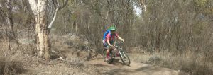
I get lots of queries about where you can mountain bike on the Southern Downs. This article gives you a summary of some of my favourite places to ride close to my home. If you live further afield, you might be interested to know what’s around here so that you can bring your bike on future visits. And if you think you’re not likely to ever come to the region, keep reading anyway because you’ll get some tips on how to find out where you can mountain bike in other regions as well.

MTB for fun, fitness and mental health
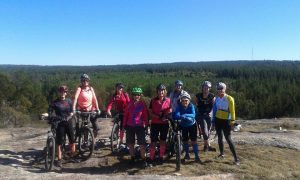
Over the last couple of years I’ve been running some mountain biking (MTB) skills clinics for beginners/intermediates in the region through The Adventure Therapy Project for Women. This community project is an initiative of Kathryn Walton Consulting and has been supported by funding from Darling Downs and West Moreton PHN. Supporting women to ride off road is important to me because I know there are many barriers that prevent women and girls getting out and having a go or consistently being involved with adventurous activities. I’ve been riding MTB for about fifteen years recreationally. I’ve competed in a few races but my love for MTB is all about getting out there for cross country rides with my family and friends and inspiring other women to do that too. It’s all about the fun, fitness and mental health.
Where is the Southern Downs?
The Southern Downs region is 1 ½ to 2 hours south west of Brisbane in Queensland, Australia, or about 1hour south of Toowoomba. The Southern Downs stretches down to the New South Wales border through the Granite Belt district and includes the regional towns of Warwick and Stanthorpe with dozens of smaller rural towns and villages throughout. There are plenty of dirt roads connecting our farm communities and groups regularly get together to ride and enjoy a coffee stop along the way.
The best places to MTB on the Southern Downs
Across the region you’ll discover National Parks, State Forests and lots of other parks. This is not a comprehensive list or description of every spot you can take your mountain bike but it will definitely get you started! You can also check the Trailforks app or website for trail information, and you can ask people who are familiar with the region. Jump on the Southern Downs Mountain Biking Club Facebook Page and ask questions anytime.
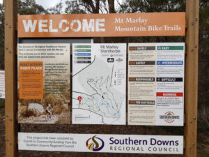
Mt Marlay MTB Bike Park, Stanthorpe
Trail head: Foxton Street, Stanthorpe
Trails: Green, blue and black cross country and downhill trails
Length: Currently total of 6-7kms of purpose-built single track with new trails under construction (as at December 2020)
Facilities: Picnic table, signage
Features: Lots of granite rock with short ascents and descents; naturally occurring rock obstacles; views; tank mural/artwork; close to CBD and accommodation
Best suited to: Riders with some prior experience riding off road who enjoy a variety of short loops
Club: Southern Downs Mountain Biking Club

Broadwater State Forest / National Park
Entrance: via Glenlyon Drive or Plant Lane
Trails: Mostly green / blue level of difficulty; cross-country
Length: Currently approximately 15 kms of multi-use cross country trails, double track and dirt roads for walkers and MTB
Facilities: Limited facilities – be self-sufficient
Features: Sandy, rocky terrain only a few minutes from Stanthorpe CBD; old-style trails; close to Granite Belt Brewery and accommodation
Best suited to: Riders of all levels; can be very hot in summer
Passchendaele State Forest
Entrance: Multiple entry points off Amiens Road
Level of Difficulty: All levels of difficulty catered for. You are permitted to ride only on formed management roads and you may require a permit if you are organising a group ride or an event.
Length: You could easily ride all day in Passchendaele!
Facilities: Limited facilities – be self-sufficient
Features: Sandy, rocky and granite terrain with some steep sections; dries out quickly after rain; 20-25kms from Stanthorpe
Best suited to: Riders of all levels especially beginners and intermediate cross-country riders

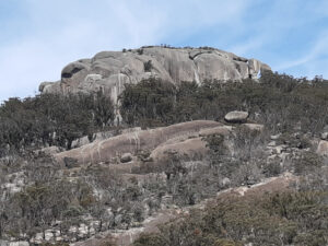
Girraween National Park – Peak and Creek Trails
Northern Entrance: Mt Norman Road – approx 5-6kms east of the Bald Rock Creek Day Use Area
Southern Entrance: Mt Norman Day Use Area, Mt Norman Road
Level of Difficulty: Green, blue
Length: The Peak Trail is 10.6kms return and can be combined with the Creek Trail which is a 3.5km loop.
Facilities: Toilet at Mt Norman Day Use Area; signage on the trails
Features: Granite terrain with some sandy sections; spectacular wildflowers in spring; amazing views of Mt Norman and other parts of Girraween; 20-25kms from Stanthorpe; car-based camping at Castle Rock and Bald Rock Creek Camp Grounds; bush camping at designated sites along the Peak Trail (permit required); accommodation nearby
Best suited to: Beginners and intermediate cross-country riders

Other parklands
There are several other State Forests and regional parks suitable for MTB in the Southern Downs Region. Remember to check for alerts (closures, bushfires, harvesting etc) and whether you need a permit to access. Locations include:
- Leyburn State Forest
- Durakai State Forest
- Gambubal State Forest
- Condamine Gorge
Maryland National Park
Maryland is not technically part of the Southern Downs Region but it’s very close and runs along the border in New South Wales. You can access Maryland National Park from Cullendore Road by turning west into Maryland Cullendore Road and following this dirt road into the park. There are no facilities and you must be careful to leave all gates as you find them. Ride the length of Maryland National Park along the dirt road from Cullendore towards Dalveen. It’s a great ride for beginner and intermediate riders through beautiful forest.
Cullendore High Country
Cullendore High Country Camping is a privately owned establishment next to Maryland National Park right next to the Queensland border. This is a working farm with beautiful camp sites and dirt roads and tracks suitable for beginner riders including children. The owners are continuing to develop on-site MTB trails with direct access to Maryland National Park.
Safety first
For a fun day out, prepare and research your mountain bike adventure before leaving home.
- Check the National Parks and State Forest alerts, Southern Downs Mountain Biking Club and Southern Downs Regional Council notifications
- Take plenty of water and some food as many of these places do not have water or shops close by
- Make sure your bike is suitable for the terrain that you’re going to ride
- Be sun safe
- Follow signage and advice from the authorities including COVID-19 regulations
- Be First Aid aware and know how to manage snake risk and other injuries
- Mobile phone service may not be reliable in all areas
- Let someone know where you are going and what time you expect to be back
For more information go to:
- Southern Downs Mountain Biking Club
- Queensland National Parks
- HQ Plantations (State Forest)
- Southern Queensland Country
- Southern Downs and Granite Belt Tourism Association
- Southern Downs Regional Council
- Warwick Chamber of Commerce
You can also listen to this article via the Outdoors is my Therapy Podcast using the link below or via your favourite podcast player / app. Subscribe so you’ll always know when the latest episode is up!
Till next time, enjoy your outdoor adventures!
Discovering mountain biking as life’s ultimate parallel universe in her middle age, Kathryn Walton shares information and reflections that inform, inspire and empower women to a healthy and active lifestyle.

